Preface: I started writing a post about sea level rise in Tonga and Thailand last summer when I was still traveling. But when I came down with malaria near the end of my trip, I never finished it. After Hurricane Sandy and a recent trip I took to Florida, I think now is an apt time to finish and post this while this issue is at the forefront of many people’s minds.
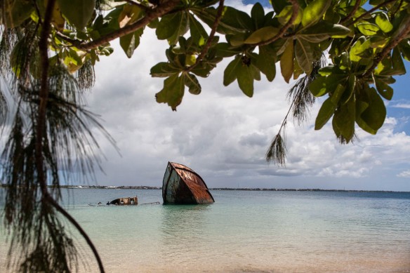 |
| A sunken boat off the island of Pangaimotu, Tonga |
Seas are rising because of
several reasons. The two primary ones being:
1) As air and ocean temperatures increase, seas expand since warm water has more volume than cold water.
2) Melting land ice from glaciers and ice caps is increasing the volume of water in the oceans.
I already mentioned the issue of sea level rise in my post on
Hawaii but the effects were much more visible in my visit to The
Kingdom of Tonga. Located in the South Pacific, Tonga is an archipelago made up of 176 islands, of which only 36 are inhabited. Along with hotter temperatures, the biggest threat facing Tonga and all low-lying nations is that of rising sea levels. The people of the Cartaret Islands also in the South Pacific have the unfortunate claim to fame of being the
first climate change refugees to be relocated due to this problem.
Compared to large developed nations like the US and China, small nations like Tonga contribute very little to greenhouse gases. Yet, this does not mean they are unaware of the causes and effects of climate change. I saw a poster at a local church encouraging residents to do what they can to fight climate change and take care of the environment.
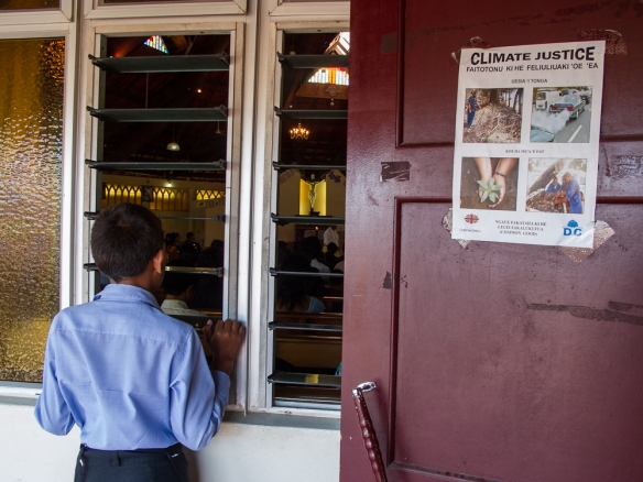 |
| Boy and climate change poster at Catholic Church in Nuka’ alofa |
To get to Tonga I flew 3 hours from Auckland, New Zealand into the capital of Nuka’alofa on the island of Tongatapu. I was greeted at the airport by Makanesi Pale – a friend of a friend of a friend… who I thought was just going to be my ride into town but “Maka” ended up being my guide, translator, travel agent and guardian angel. He dropped me off to have my first “couch-surfing” experience with Katherine, a German nurse cum dive master working in Tonga, and her 2 roommates. They welcomed me into their home and quickly confirmed my suspicions that “
Couchsurfing” is an amazing global social network helping travelers find a place to crash for free and/or someone to proudly show you around their town.
Since I had read that Sunday is primarily a church-going day in Tonga, I asked Maka if he could take me to his. The main reason I wanted to go was to hear the
singing which was indeed heavenly. The Catholic wooden-framed church was simple but elegant.
I was also enchanted with the traditional clothing that many of the parishioners wore. Men commonly wear taʻovala or “mats” around their waist to show respect. The kiekie is the more decorative version worn by women. When a family member dies, Maka told me that the surviving members will wear all black clothing plus a more elaborate ta’ovala for up to six months.
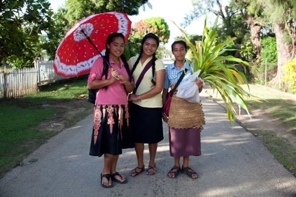 |
| The boy in this picture is wearing a ta’ovala while the girl on the left is wearing a kiekie. |
After Mass, Maka took me out to the island of
Pangaimotu . It was brutally hot under the midday sun and although I would have preferred to be there later in the afternoon to photograph, the last boat back was at 2pm. Maka wanted me to see how the coconut trees were being killed by the salty ocean waters that flood the island every day at high tide.
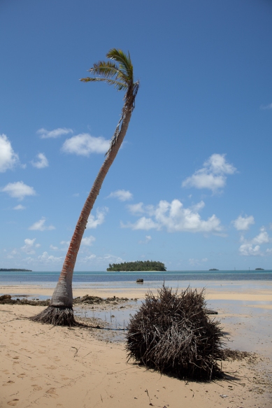 |
| Coconut trees being killed by rising sea levels |
He pointed out that local residents are trying to create a protective barrier around this island by planting mangroves along the coastline, but the ocean seemed to be winning the battle. Some of the mangroves were starting to grow but it would be a long while before these small saplings could offer any protection for the island.
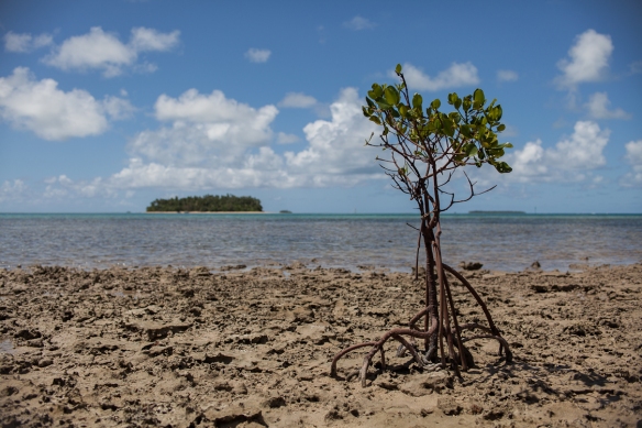 |
| Mangrove sapling planted to try to hold back rising seas that are killing vegetation on the island |
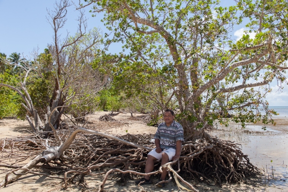 |
| Maka trying to cool off in some shade on Pangaimotu Island |
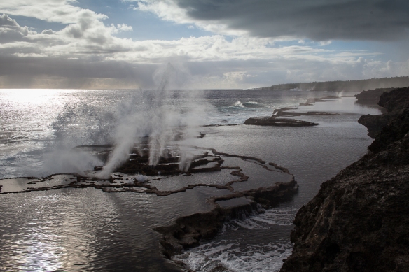
After returning to Nuka’alofa, Maka gave me a tour of Tongatapu – the kingdom’s largest island. We ended our tour at a spectacular place: the island’s blowholes. With the setting sun back-lighting the streams of water the effect was magical.
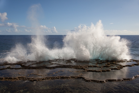 |
| Tongapatu’s magical blow holes |
I was mesmerized as water hit the rocks below me and then shot up sky-high through these naturally created blowholes. All the way up the coastline I could see spouts of
dancing water. I wondered aloud if rising sea levels will take away this delightful experience once the water gets high enough to cover the rocks 24/7 instead of just crashing into them at high tide. Maka said he didn’t know but it could happen. I might have to go back in ten or twenty years and see what has become of this mystical phenomena that is one of the highlights of a visit to the capital.
Curious to see what was happening to some of the smaller Tongan islands, I headed north to the
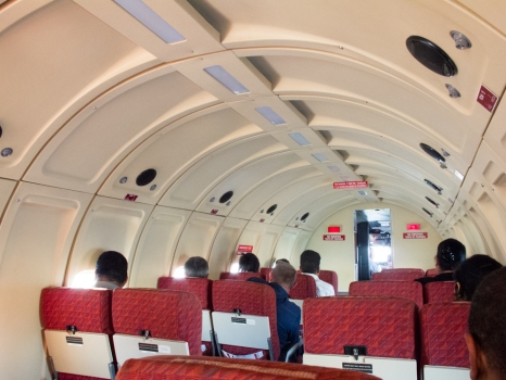
Ha’apai group of islands. I had wanted to take a ferry but was told it did not run on the days I needed to travel. I was lucky to get a seat on a renovated 1940′s DC-3 plane. Clearly Chatham Pacific (“The Friendly Airlines”) is very proud of it for in each seat-pocket they had a history of the plane they named “Tangaloa” or “God of the Sky.” Due to the slow pace and simple lifestyle of Tongans I was already feeling like I was in another era. Once I got on this cool retro plane I really felt like I had traveled back in time.
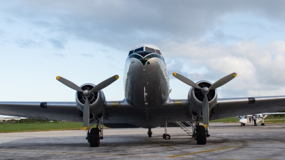 |
| The renovated DC-3 plane that took me to Lifuka. |
Maka had arranged for me to stay at Evaloni’s Guesthouse in Pangai on the island of Lifuka. From my second floor balcony I enjoyed watching the school children and teachers walk to and from school. I discovered I was not the only one who found the March sun to be blisteringly hot as I watched the passersby shield themselves with parasols, books, and one student even used his guitar.
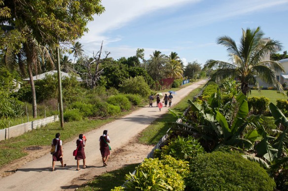 |
| Students walking to school in Pangai under the heat of the morning sun |
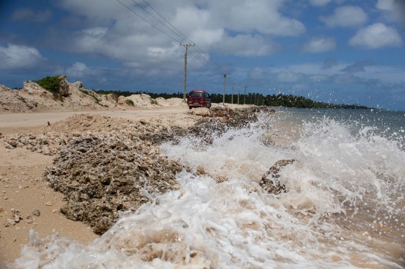
A couple of times in the late afternoon I borrowed a bike and rode up and down the island’s main road looking for areas to photograph that showed signs of the rising sea. I didn’t have to look hard as all along the shoreline I could see the effects from the rising waters and the erosion it was causing. Tupou mentioned that recent heavy storms had caused significant damage to the local hospital and that residents were now considering whether it should be moved more inland.
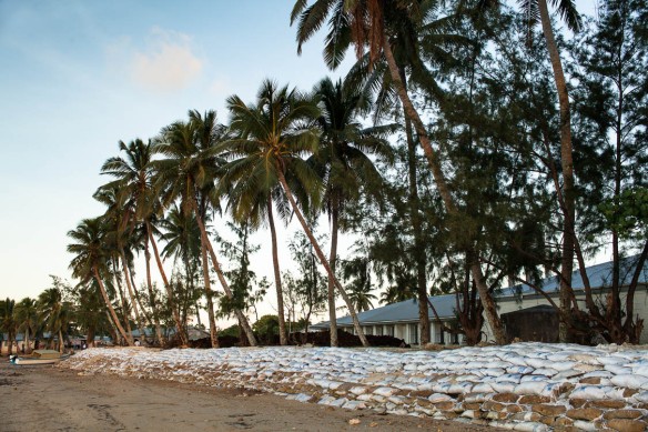 |
| Sandbags have been put up along the shoreline to try to protect Pangai’s hospital from further damage from rising seas and storm surges |
In Tonga “inland” is a relative term since many of the islands are very narrow and long, so moving buildings away from the shores is only a temporary solution. From the western end of the island, residents used to be able to walk over to nearby
Uoleva island at low tide, but this practice had now become obsolete ,as well as dangerous. Due to rising sea levels the water is never low enough to cross safely at any time of day.
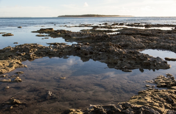 |
| View from the tip of Lifuka to Uoleva |
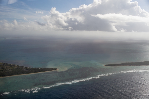 |
| An aerial view showing how close Lifuka and Uoleva are |
At the other end of the Lifuka, there is a narrow causeway that allows locals to drive to the next island of Foa. Apparently high tide now covers the road on a daily basis requiring a road crew to be on standby for frequent repairs.
Since there was no way to walk to Uoleva I took a boat there to stay at Captain Cook’s Hideaway. There are no roads or cars on this island so the pace of life is even more laid-back. The owner Sonny told me that he has noticed the change in sea level. He gave me a postcard that depicted a little bench he had made from driftwood for guests to watch the sun set over the water. “One day a few years ago I went out and the ocean had taken that bench. It was just gone,” he said.
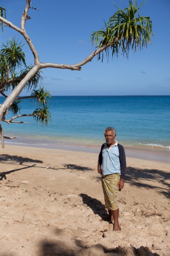 |
| Sonny showing me the spot where his bench used to be |
Since it was off-season and I was the only guest, Sonny let me pick which fale (beach hut) I wanted to stay in. I chose the one closest to the water.
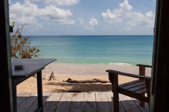 |
| Adicionar legenda |
From my front door, I counted just eight steps to where the ocean came at high tide. I wonder how many years it will be before the water will reach the hut. Sonny told me: “I didn’t want to build that close to the water’s edge, but I have some guests who have come for thirty years and they begged me to build a hut closer to the ocean. Now I regret it, “ he lamented.
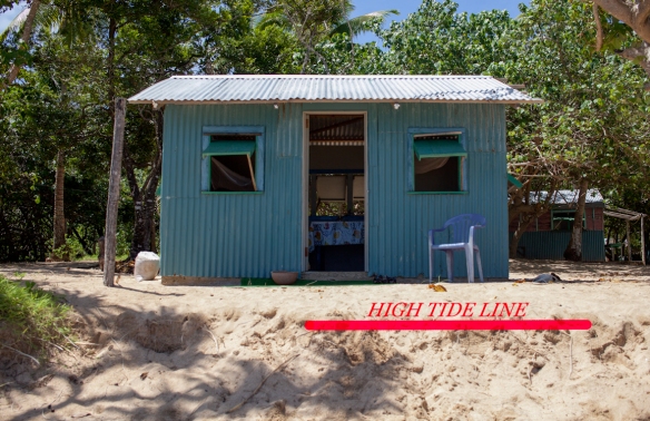 |
| My fale at Captain Cook’s Hideaway. The red line marks the top of the water during high tide – just 8 short steps to the door |
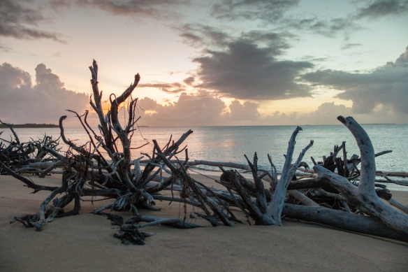
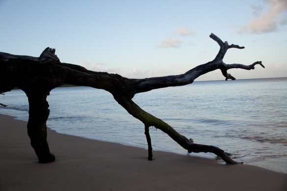
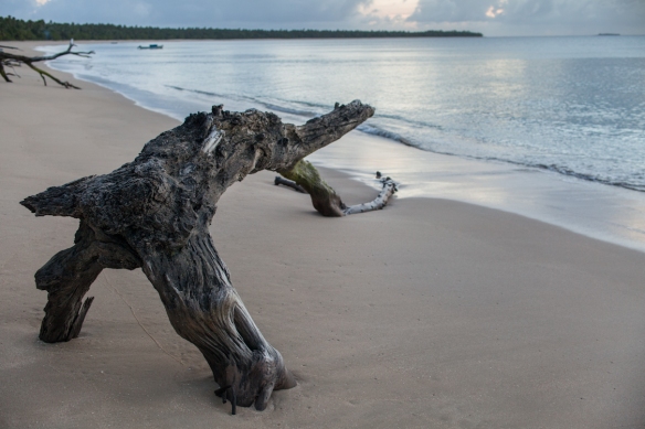
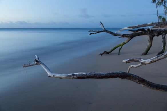
I told him that some people in the US don’t believe that problems like rising sea levels are connected to global warming. He said they should just come there and see it for themselves. All along the shoreline, felled trees littered the beach. It reminded me of a graveyard or a battlefield with wounded soldiers.
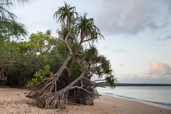 |
| Trees next to my hut that are on their “last legs.” |
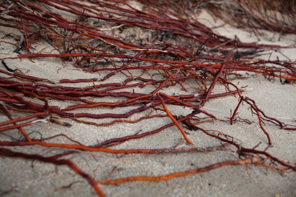
At the edge of the beach, the red roots of palm trees were sticking out. They looked like exposed veins, raw and vulnerable.
At twilight, many of the trees looked like creatures that were crawling into or out of the sea.
I felt conflicted. Here I was in this beautiful tropical environment and yet everywhere I looked there were clear signs of how climate change is negatively impacting the landscape. It was a bittersweet experience. I wanted to chill out and just soak up the sun and surf while I was there but it was hard to relax wondering if Tongans will have the same fate as their Pacific neighbors of the Carteret Islands and have to leave their islands to find homes on higher ground. With sea levels
predicted to rise at least another 18 – 55 cm (7- 22 inches) by the end of the century, it might only be a matter of time before my fale ends up being a house-boat floating out to sea.
Next up: Sea Level Rise – Part 2: Thailandhttp://witnesstreephotography.wordpress.com/tag/rising-sea-levels/









Comentários
Postar um comentário